Remote Sensing
Contact us to discuss your specific requirements.
Contact us to discuss your specific requirements.
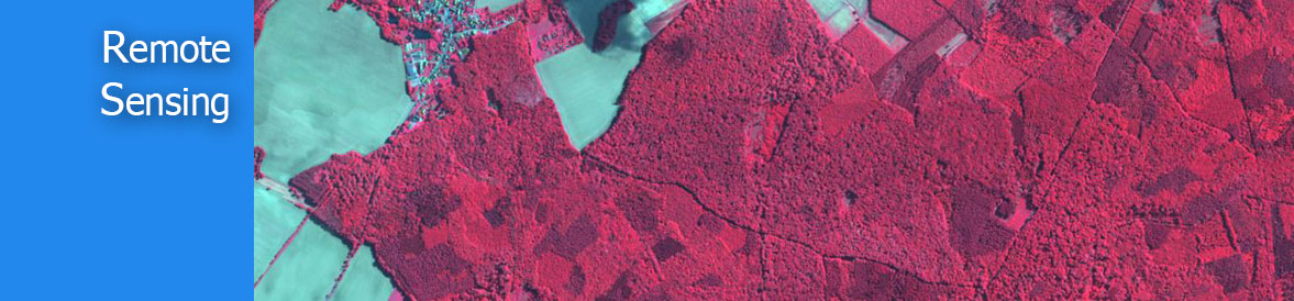
At Skylabs we offer an extensive high scope of remote sensing, photogrammetry and radar services that will effectively help your association in utilizing extra advantages from satellite and elevated symbolism. Through grouping, mosaicking, re-projections and picture elucidation forms we can build up definite data about land utilize and arrive cover. Our strategies can open new windows into the inconspicuous world, conveying crisp experiences into our physical scene.
Physical survey is not a viable and effective option this time as some projects require a large scale acquisition of information on objects. Remote sensing is a technique that is time and cost effective and is therefore advantageous for such projects.
Skylabs Solutions offers remote sensing services to its clients worldwide. The services ensure accurate cost-effective data collection which is important input for planning and designing of mapping projects. Our services in remote sensing covers a huge range of applications such as spatial modeling and analysis , image analysis and classification , land cover mapping and terrain categorization , color balancing, mosaicking and compression, LiDAR editing and classification, Feature capture and update, terrain creation, editing and analysis orthorectification are very few to measure.
We offer remote sensing services by creating data to analyze and compare data of forestry, weather, vegetation, pollution, erosion, land use, city planning, military observation, archaeological investigations, and so on and on. Our technical teams have good hands-on experience of using remote sensing software’s like Geoserver and OSM etc.
With remote sensing technique you can retrieve large amounts of data, reduces manual field work dramatically. Remote sensing allows retrieval of data in regions difficult or impossible to access plus you can collect a lot more data in a short period of time.
Basically Remote sensors collect data by detecting the energy that is reflected from earth. These sensors can be on satellites or mounted on aircraft. Remote sensors can be either passive or active. Passive sensors respond to external stimuli. They record natural energy that is reflected or emitted from the earth's surface. The most common source of radiation detected by passive sensors is reflected sunlight.
Start right now.